Once you know how to use Google Maps live view, you can use your phone’s camera to keep you on track. Not only can you use it to get Augmented reality directions from street signs, it can also be used to identify local businesses and receive Google reviews and information on them.
With all that functionality, you might think Google Maps Live View is tricky to use. Thankfully, though, it’s super easy, and we’re here to show you how.
When using Live View out and about, remember to stay aware of what’s going on in the real world, especially when other people and roads are around. With that out of the way, here’s how to use Google Maps Live View.
1.Open Maps
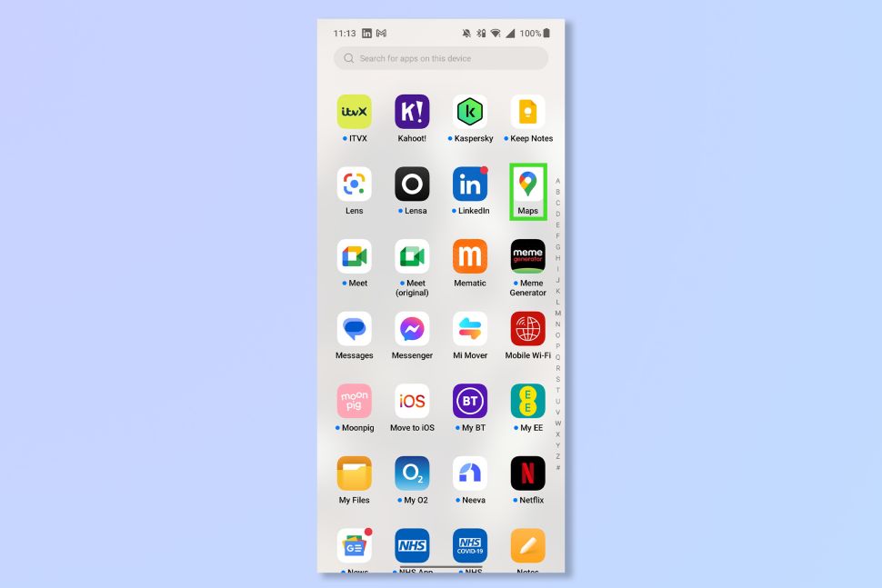
Open the Google Maps App or go to www.google.com/maps.
2.Enter a destination and tap Directions
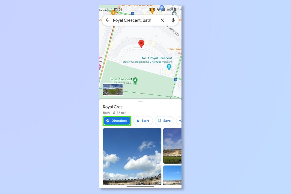
Enter a destination in the search bar and then tap Directions to begin navigating to your destination.
3.Tap Walking View and Tap Live View
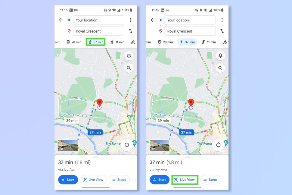
Tap on the image of a person walking to switch to Walking view and then tap Live View.
4.Point the camera at key features

Aim the phone camera at features such as street signs and businesses. You’ll be given pointers for the direction you need to walk in. When you approach your destination, you’ll see the red marker.
There you go, it’s just like having Google Glass on your phone right? And now you’ll never be late for anything ever again.